Earlier this year NOAA Coastal Services Center and NOAA’s climate.gov debuted an interactive mapping tool showing the effects of sea level rise on the US coast. I learned about the Sea Level Rise Viewer in the video above.
Though we’re in no danger in Pittsburgh my family lives within 10 miles of the coasts of Virginia, Maryland, Florida, Massachusetts and New York so I was particularly interested in those places. Some places near them, such as Norfolk, Virginia, are already experiencing nuisance flooding.
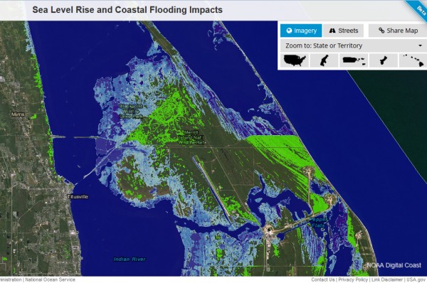
Using the tool I zoomed in on a favorite birding location: Merritt Island National Wildlife Refuge off Titusville, Florida.
One foot of sea level rise will put some of Merritt Island underwater and surround the access road from Titusville. Two feet will make it impossible to cross from Titusville and will bury Blackpoint Wildlife Drive. Here’s a screenshot of the two-foot rise.
Try the tool yourself.
- Watch the video above to see how the Viewer works.
- Click on this link for the Sea Level Rise Viewer.
- Enter an address in the search box or double-click on the map to zoom in on your favorite place.

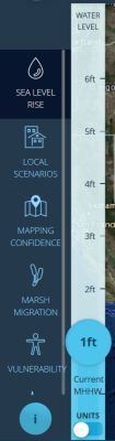
- Now use the controls on the left panel to see the effect. Move the blue sliding bar up to make the water rise.
It’s amazing what a little rise in sea level can do. Some day Merritt Island will disappear.
(video and screenshots from NOAA Coastal Services Center)
And then come the tides…