Reflections on a trip to Costa Rica, Jan 27-Feb 6, 2017:
One of the unusual features of Costa Rica’s landscape is the bumpy-looking surface in the subduction zone. Pennsylvania has nothing like it.
Near Costa Rica’s Pacific shore the Cocos tectonic plate dives under the Carribean plate. This slow but relentless movement causes ripples in the landscape with small stand-alone hills and pockets where the surface was dragged under. (Here’s a diagram of tectonic subduction.)
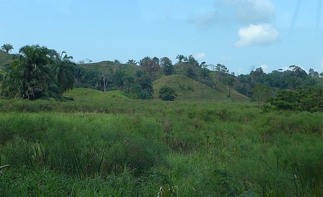
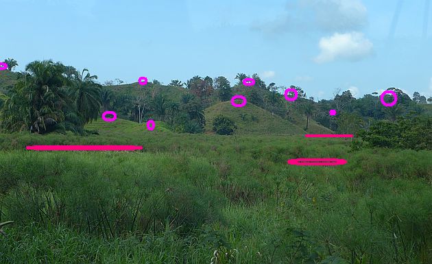
The photo above was taken in the subduction area on Route 34 near Quepos. Below, I’ve marked light pink circles for each small hill and dark pink for the visible subsidence pockets among the grass.
This isn’t a stable place to build anything. Even the road has dips and ripples.
We don’t have a subduction zone in southwestern Pennsylvania but we know something about subsidence. In Washington and Greene Counties, longwall mining machines remove the coal seam and then back out of the mine causing the roof and surface to collapse. You can see its effect in the roller coaster appearance of Interstate 79 in Washington County. Click here for DEP photos of longwall subsidence problems on Interstate 70 and here for a map of locations where longwall mining has undermined both I-70 and I-79.
Pennsylvania’s man-made subsidence has a cost.
(photos by Kate St. John)