A trip to Hawaii would not be complete without a visit to an active volcano at Hawai’i Volcanoes National Park. If it weren’t for volcanoes Hawaii wouldn’t exist.
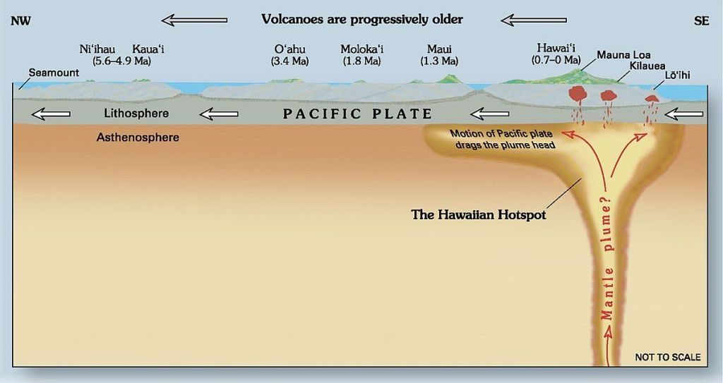
The Hawaiian island chain is a string of mountains created by a volcanic hotspot under the Pacific plate. As the plate moves northwestward, the hotspot keeps bubbling up in a new location. The older islands have extinct volcanoes. The newest island, the Big Island of Hawai’i, is where all the action is.
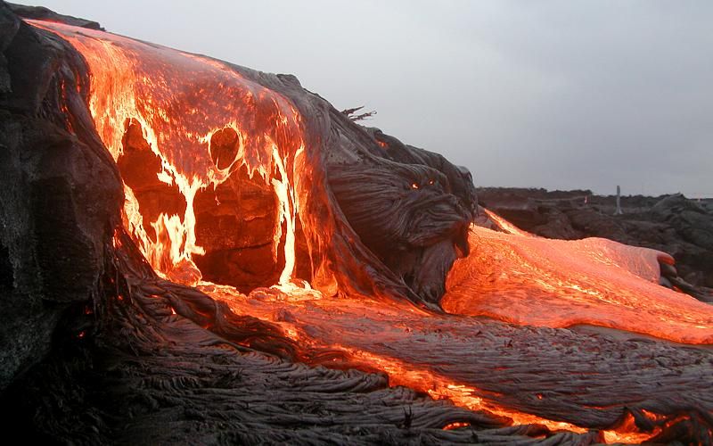
Volcanoes are incredibly awe inspiring and deadly if not treated with respect. Explosions, fountains, and lava flows are obvious dangers. Volcanic ash clogs everything (including airplane engines) and the sulfur dioxide emissions can kill.
Hawaiian tradition says that Pele, the goddess of volcanoes and fire, lives in the crater of Kilauea and controls its lava flow. For centuries Hawaiians made religious visits to offer her gifts. Sometimes those visits ended badly. Wikipedia explains that “In 1790, a party of warriors (along with women and children who were in the area) were caught in an unusually violent eruption. Many were killed and others left footprints in the lava that can still be seen today.”
Kilauea has been continuously active since 1983. When it erupted violently from 3 May to 4 September 2018 its lava flows destroyed Highway 132, the beach towns of Vacationland and Kapoho, and parts of the Leilani Estates subdivision. By the time the eruption ended Kilauea had added 875 acres of new land to Hawai’i.
This U.S. Geological Survey video shows conditions at Leilani Estates in late May 2018 while a USGS team monitored the lava flow.
They also monitored it from the air in this flyover from lava fountain to the sea.
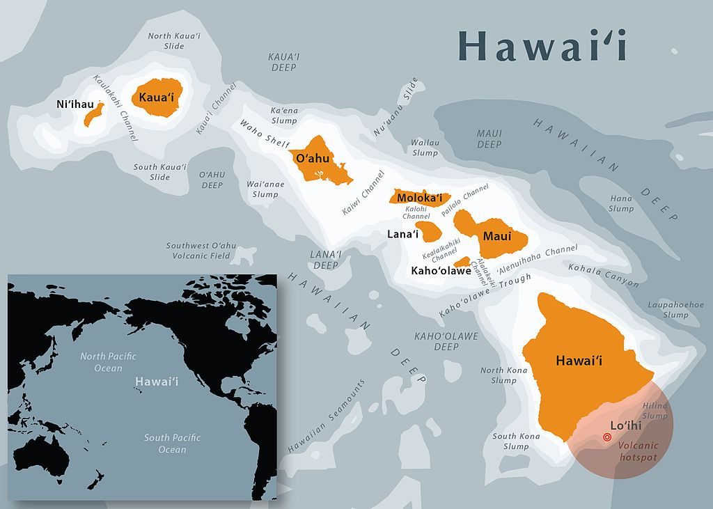
Meanwhile a new volcano is growing offshore. Lo’ihi is already 10,100 feet above the sea floor and only 3,000 feet below the waves. Right next to the Big Island, its shape is the pale orange semi-circle on the map below.
Hawaiians know there’s no way to control a volcano. All you can do is get out of the way!
(videos by USGS on YouTube, photos and maps from Wikimedia Commons. click on the captions to see the originals. )
Tour Day 8: Hawai’i Volcanoes National Park