17 January 2023
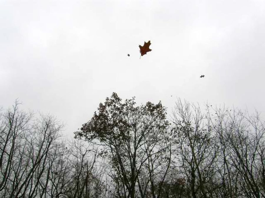
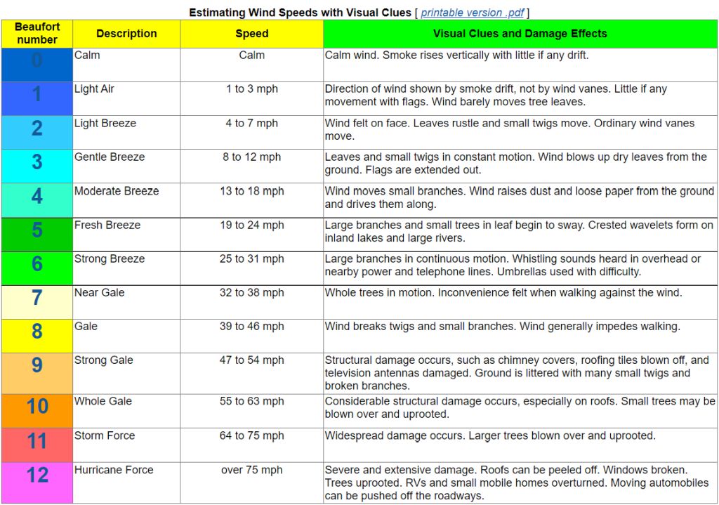
We can’t see the wind but we can guess its speed by watching what it does to leaves and flags …

… and then using the wind speed chart from the National Weather Service (NWS) to make a guess. My guess for the above photos is a Gentle Breeze 8-12 mph or a Moderate Breeze 13-18 mph but it’s hard to tell.
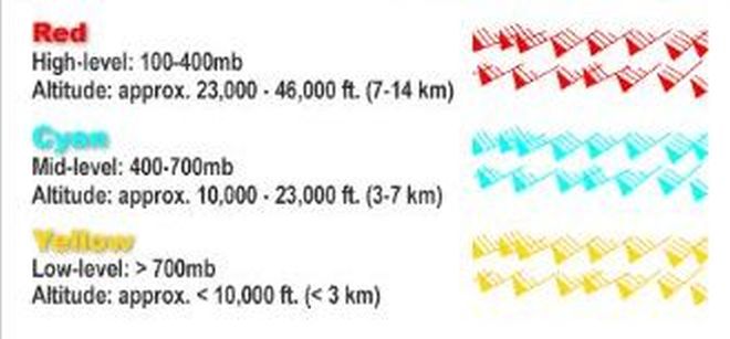
NOAA weather satellites don’t see the wind either but they can see the clouds moving in three layers.
- High level clouds (cirrus) at 23,000 to 46,000 feet
- Mid level clouds at a level of 10,000 to 23,000 feet
- Low level clouds are below 10,000 feet
In their animations of satellite images we can almost see the wind but not its speed.
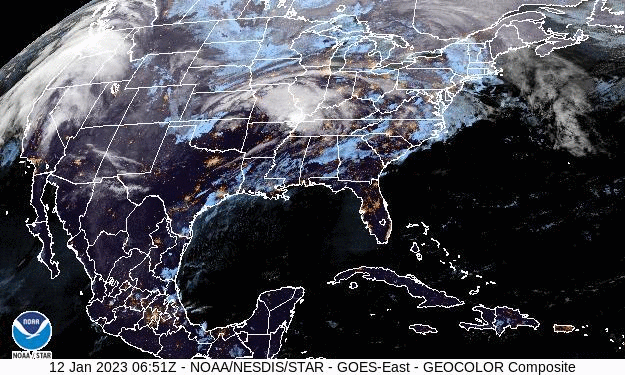
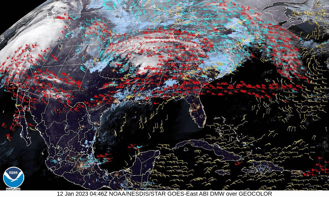
For instance, in this GOES East animation from last Thursday 12 January 2023 we can see the Atmospheric River pumping into California and a low pressure system moving up the Ohio Valley.
NOAA’s computers use the animated maps to calculate wind speed and direction. The result, called Derived Motion Winds, plots the wind height, direction and speed on a map.
Here’s the same timelapse with Derived Motion Winds. Notice that the layers often don’t move in the same direction or at the same speed. You’ve felt this in an airplane as a “bump” when the plane rises or descends between conflicting layers.
You can “see” the wind anywhere in the Americas by choosing a satellite to view (list on the left) at the NOAA GOES Imagery Satellite Maps. Click on Derived Motion Winds if available.
To view the current GOES East satellite, pictured above, visit these links:
- GOES East satellite, all images: https://www.star.nesdis.noaa.gov/GOES/conus.php?sat=G16
- GOES East satellite, Derived motion winds: https://www.star.nesdis.noaa.gov/GOES/conus_band.php?sat=G16&band=DMW&length=24&dim=1
(photos from Marcy Cunkelman and Wikimedia, maps and animations from NOAA and the National Weather Service)