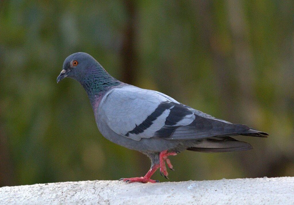
City folks often see pigeons but all the birds are adults. Have you ever seen a baby pigeon?
Rock pigeons nest on cliffs in the wild or in nooks on high buildings or bridges in feral settings. This puts their nests high above our field of view and, since the young won’t leave the nest until they can fly, they don’t look like babies anymore when we finally see them. They look like their parents.
Every once in a while a pair of pigeons will choose a balcony or window ledge where the resident can see the nest. This happened for @LostInTheWildCanadawho documented the pigeon family on YouTube.
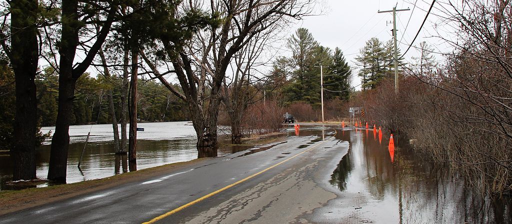
Monongahela River flood at Duck Hollow, 10 Sept 2018 (photo by Kate St. John)
2 April 2024
CORRECTION (3 APRIL at 7am): When I first published this article, I didn’t realize I was using outdated maps so my analysis was wrong. NOAA changed to their mapping tool on 28 March; the new tool is much better. Maps, links and the flood assessment have been corrected.
Today (2 April 2024) it will be warm in Pittsburgh (71°F) but very wet with severe thunderstorms, 2-3 inches of rain, and up to 4 inches in localized downpours. There’s a Flood Watch through this evening for rivers, creeks, streams, and flood-prone locations.
It is unlikely that the Monongahela River will flood as much as it did in 2018, above in September, below in February. But it will reach flood stage.
The river is expected to rapidly rise Wednesday (3 April) and crest at 26.7 feet early Thursday (4 April), just below the moderate flood stage. As of Wednesday morning, it was over 21 feet.
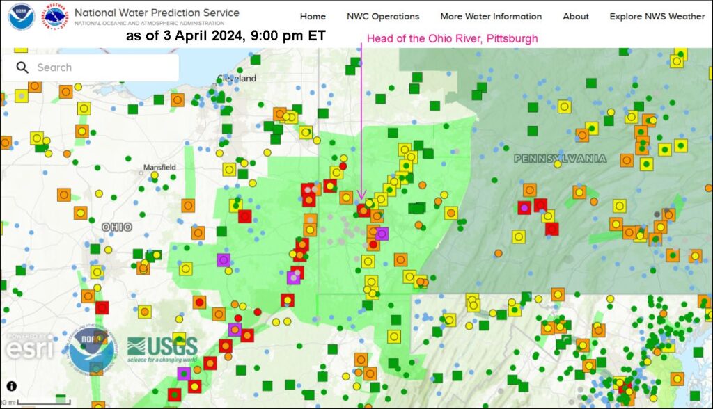
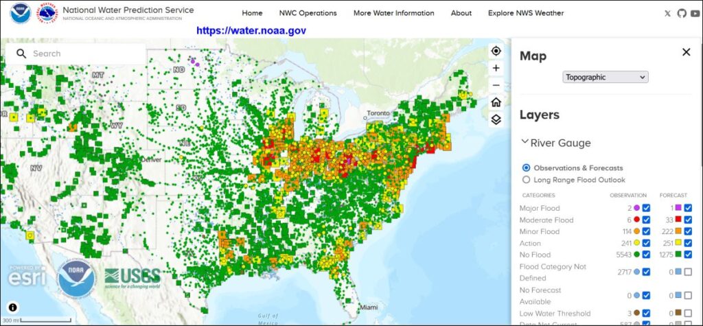
The National Water Prediction Service provides a dynamic water prediction map for the entire U.S. updated with current conditions (circles) and water level predictions (squares around the circle). The colors on the 4/3/2024 at 9:00pm map below mean:
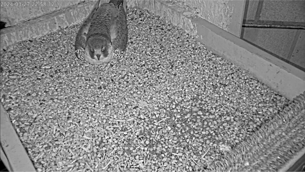
Carla and Ecco have completed nearly two weeks of incubation at the Pitt peregrine nest and have three more to go. As we watch them on the National Aviary falconcam it can be difficult to tell who’s on camera because their appearance is similar. Here are some tips for figuring out which bird is on the nest right now.
Nighttime incubation? It’s Carla except …
Carla incubating at night, 27 March 2024, 10:58pm
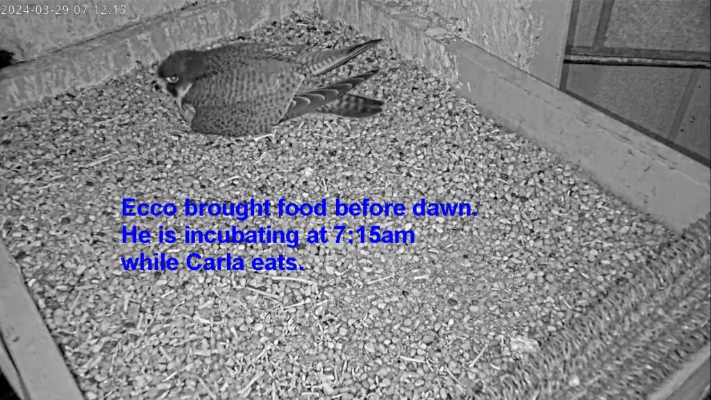
Ecco sometimes brings food before dawn so you may see him on the nest in the early morning while Carla eats.
Ecco on the nest before dawn, 29 March 2024, 7:15am
Whenever you’re in doubt, use these tips.
Size: Carla is larger
Male peregrines are one-third smaller than females so size is the obvious way to tell the difference between the Pitt peregrines (see slideshow at top). However, Carla is not an enormous female and at close quarters on the falconcam with her back turned I have a hard time identifying her by size. The difference is obvious in this slideshow but not when Carla is alone on camera.
Plumage: Carla is Scalloped, Ecco is Striped
This spring in fresh breeding plumage Carla’s feathers have white tips that make her appearance look scalloped. Ecco’s feathers do not have long white tips so he looks vertically striped with fine black lines. Note that this difference works right now but feathers are dynamic and will not look the same in a few months.
Quiz! Test your skills
Practice recognizing size and plumage differences in this short video that compresses 60 hours into 1:41 minutes. At this speed the size differences between Carla and Ecco are obvious but you’ll have to look at one spot on the screen to notice plumage. Stare at one place and think “Scalloped or Striped?”
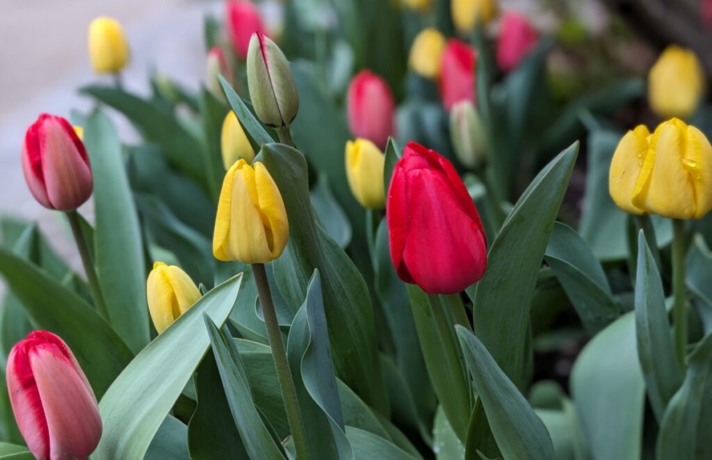
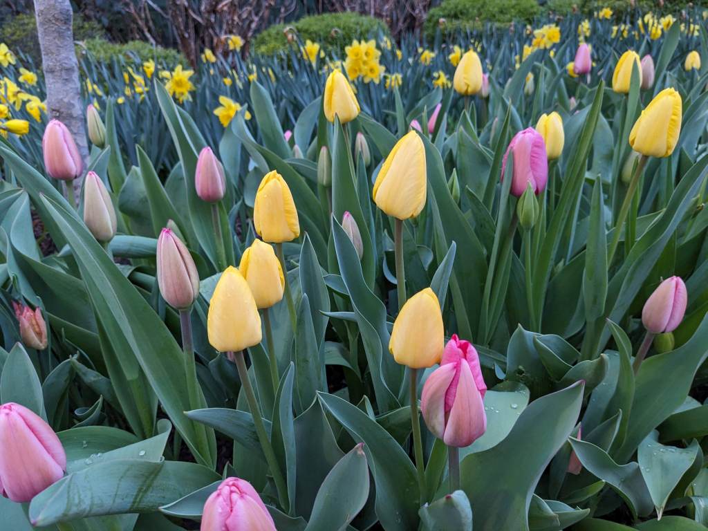
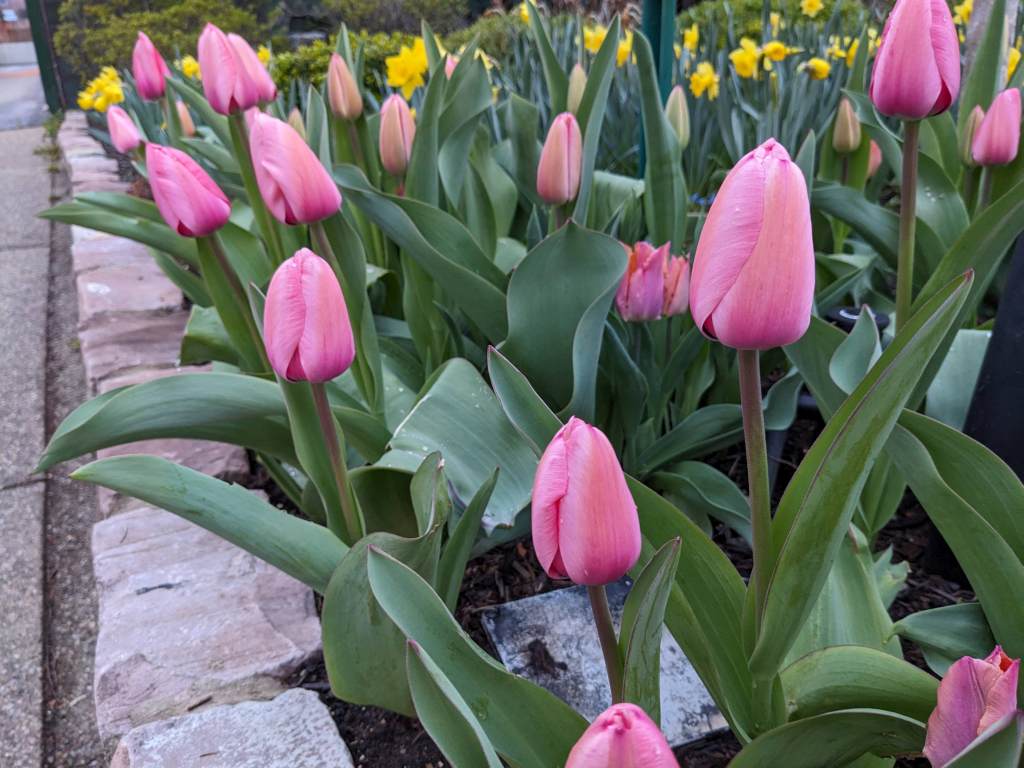
Tulips on Easter morning in the Oakland neighborhood of Pittsburgh, 31 March 2024 (photo by Kate St. John)
31 March 2024
Easter is early and so is Spring. Tulips are blooming in my city neighborhood.
Tulips on Easter morning in Oakland, 31 March 2024 (photo by Kate St. John)Tulips on Easter morning in Oakland, 31 March 2024 (photo by Kate St. John)Tulips on Easter morning in Oakland, 31 March 2024 (photo by Kate St. John)
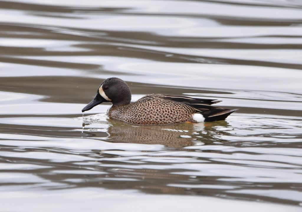
Blue-winged teal, Moraine State Park, 27 March 2024 (photo by Charity Kheshgi)
30 March 2024
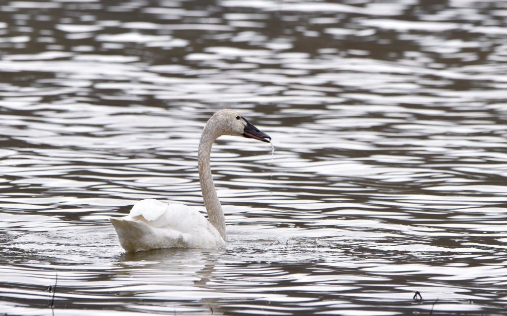
A Wednesday trip to Moraine State Park was cold and gray but quite worthwhile. We saw 300(!) red-breasted mergansers, many ring-necked ducks, blue-winged teal and a rare bird — a trumpeter swan. Charity Kheshgi’s photos show off the teal and swan.
Trumpeter swan, Moraine State Park, 27 March 2024 (photo by Charity Kheshgi)
Trumpeter swans (Cygnus buccinator) are “the heaviest living bird native to North America and the largest extant species of waterfowl.” They were nearly extinct in 1933 — only 70 remained in the wild — but several thousand were then found in Alaska. “Careful re-introductions by wildlife agencies and the Trumpeter Swan Society gradually restored the North American wild population to over 46,000 birds by 2010.” The trumpeter at Moraine is one of their descendants. (quotes from Wikipedia)
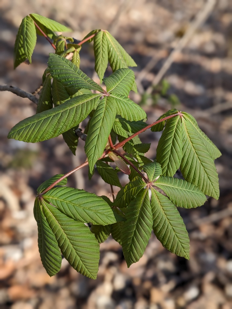
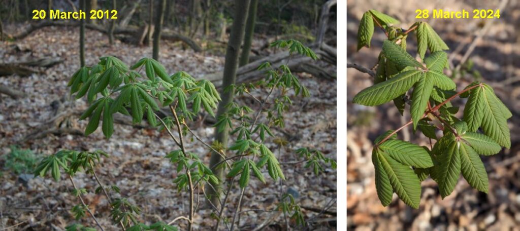
Comparing two springs, yellow buckeyes’ early leaf-out, Schenley, March 2012 and 2024 (photos by Kate St. John)
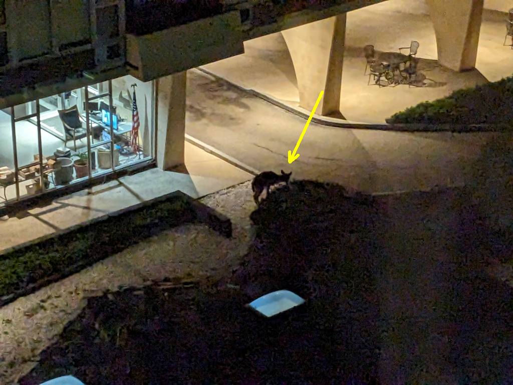
Early spring is the hungriest time of year for deer in Pennsylvania because they’ve already eaten all the easy-to-reach food. When the deer population is greater than the area’s carrying capacity they seek out food in unusual places. Thus I was amazed but not surprised to see a deer browsing the bushes next to our highrise at 5:30am. There is nothing to eat down there. There is nothing to eat anywhere near here.
A deer browses at a highrise in Pittsburgh, 5:30am 24 March 2024 (photo by Kate St. John)
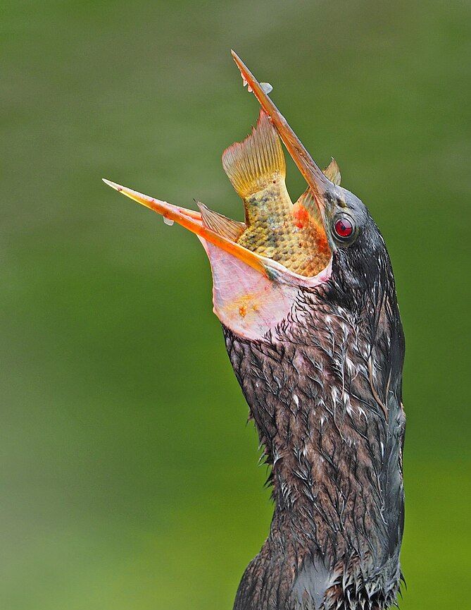
Unlike herons, anhingas spear their prey but this means they can’t open their beaks to swallow. This video shows what they do to solve the problem.
Anhingas go by many names. Some people call them snake birds. Others call them piano birds. Regardless of the chosen label, anhingas are pretty unique little dinosaurs. They catch their prey underwater by spearing it and when they surface, they have to somehow unspear it. pic.twitter.com/JamqyJLoBE
— Mark Smith Photography (@marktakesphoto) March 23, 2024
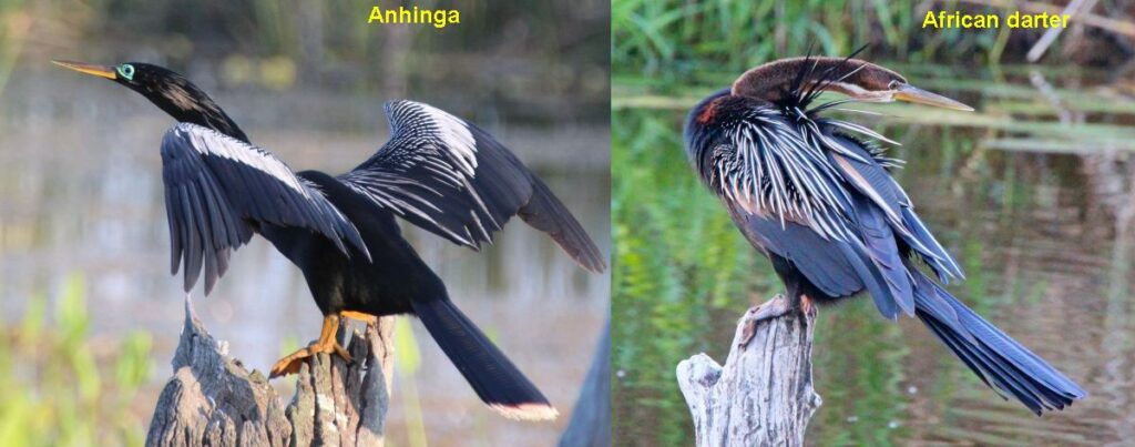
p.s. There’s a bird in Africa that looks like an anhinga (Anhinga anhinga). Closely related, the Anhinga rufa is the “African darter.”
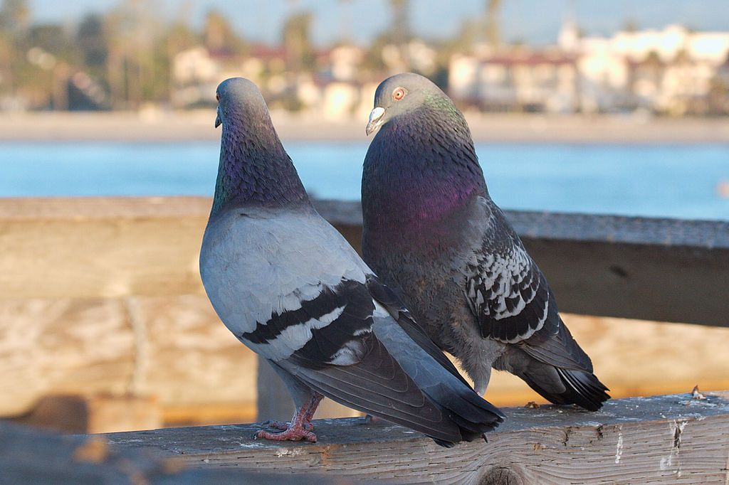
Peregrines hang out where their food is plentiful so they’re often in places with lots of pigeons. Watching peregrines, as I often do, means waiting (bored) for them to choose the perfect moment to catch a bird. Inevitably I watch pigeons while I wait for peregrines so I’ve seen a lot of pigeon courtship.
Most birds have a breeding season for a few months per year in spring and summer but rock pigeons, like humans, breed over and over all year long if there’s enough food to sustain their families. You can tell when they’re starting a new family because they court conspicuously.
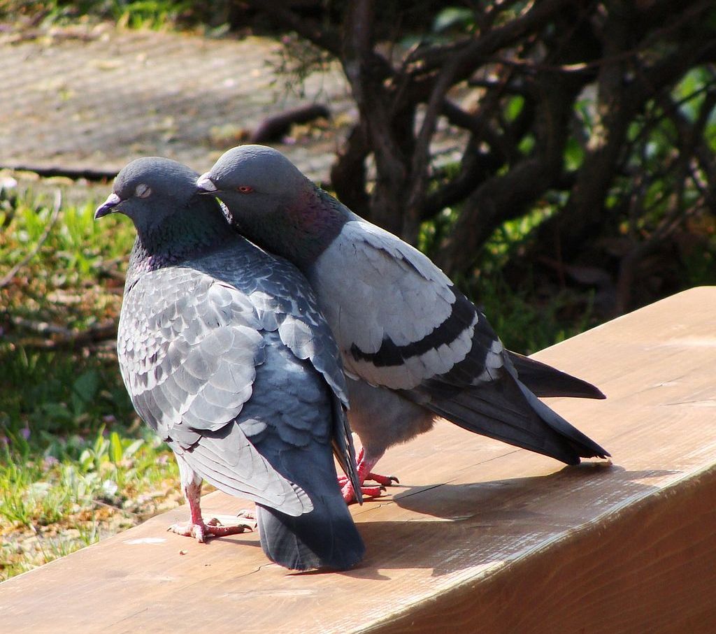
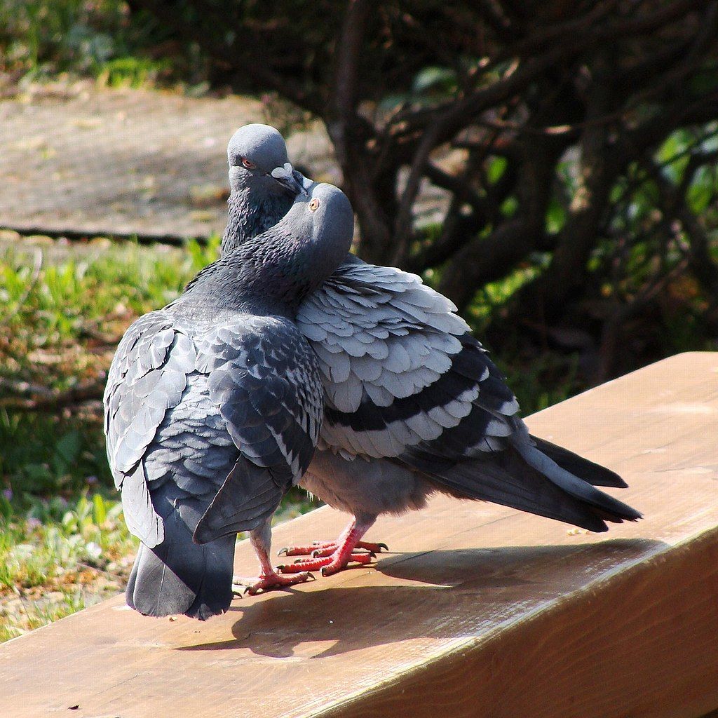
[Courtship] Begins with bowing and cooing, in which male stands tall, inflates crop, fans tail, struts in circle, bows head and neck while giving display coo. This is repeated many times while circling and moving around the female.
Hetero-preening (“nibbling”) follows, male first, female later.
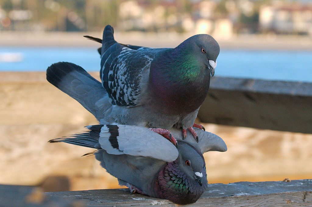
After mating the male may do a post copulatory display. Sometimes they fly together.
Post-copulatory display includes a few steps while standing tall, and often a display flight, usually by the male, in which wings are clapped together on an exaggerated upstroke for 3–5 wingbeats. Bird flies out to another perch, 40–80 m distant, clapping wings at least once and gliding with wings in a “V” between bouts of clapping
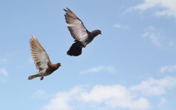
Two rock pigeons flying (photo from Shutterstock)
While you’re observing pigeon courtship there’s one more thing to notice. The male and female do not have the same plumage patterns because they choose mates that don’t look like themselves.
Akashinga Rangers set off on a patrol to establish an overnight observation post at Phundundu, near Nyamakate, Zimbabwe (photo by Davina Jogi embedded from akashinga.org)
27 March 2024
Before Women’s History Month draws to a close here’s some recent women’s history in Zimbabwe.
Poaching is a persistent problem in southern Africa because the body parts of exotic wild animals find a lucrative market in the outside world. Without effective patrols it can even happen in a national park as for example 11 years ago, in 2013, when poachers poisoned 41 elephants at Hwange National Park by putting cyanide in their watering hole.
To stem the tide of animal deaths Australian born Damien Mander founded Akashinga in 2009 to train squads of men to protect wildlife in their home areas. The men were too easily corrupted and poaching continued.
In 2017 he recruited women, many of them single mothers or formerly abused. They named themselves Akashinga — The Brave Ones in the Shona language — and the program has been a great success, not only in terms of wildlife but within their communities.
Today Akashinga has a team of 500+ staff and 9.1 million acres under management in Zimbabwe, Botswana and Mozambique. They have reduced poaching by 80% and have seen an increase in wildlife of 399%.
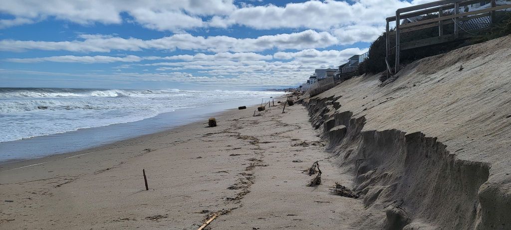
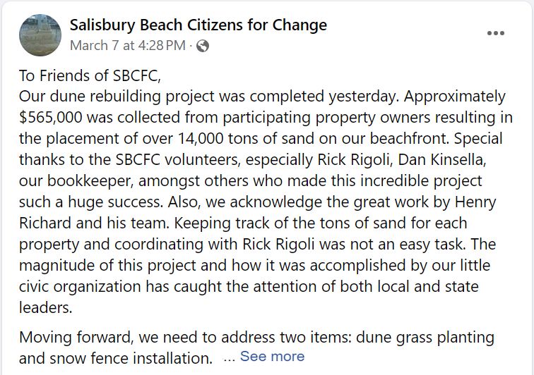
A decades-old problem became acute his winter. After high winds and a historic high tide damaged 20+ beachfront homes in January at Salisbury Beach, Massachusetts, the residents took up a collection to build a protective dune. It took five weeks, 14,000 tons of sand and more than half a million dollars to build the dune to protect the homes. Three days later it was gone.
Completion of the dune project in early March brought high hopes to Salisbury Beach.
The temporary dune did it’s job — no homes were damaged in March — but the idea of spending half million dollars after every storm is out of the question. So the town is regrouping and weighing options.
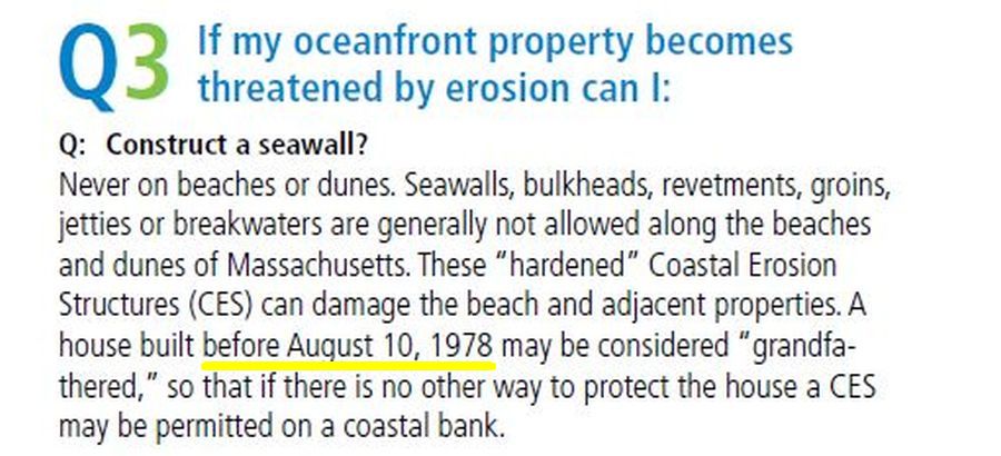
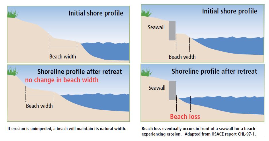
You might be wondering: Why don’t they just build a seawall?
Seawalls just move the problem a few hundred feet down the beach so they are generally not allowed in Massachusetts (see special exception in yellow).
Also, a seawall will remove the beach entirely as shown in this diagram. If Salisbury Beach builds a seawall they will have no beach at all, just a wall with a sheer drop to the ocean. Understandably, the homeowners want a beach.
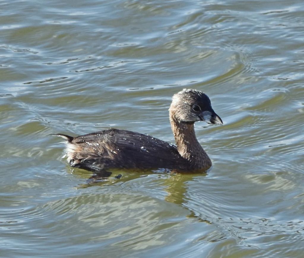
Pied-billed grebe at Duck Hollow, 21 and 24 March 2024 (photo by Charity Kheshgi)
25 March 2024
Yesterday at Duck Hollow it was brilliantly sunny and *cold.* Though the temperature was 27°F the light wind made it feel like 17°F. Brrrr!
Charity Kheshgi and I scouted on Thursday and found a pied-billed grebe near shore who was still present in the same zone on Sunday. Alas, the seven horned grebes we saw on Thursday were long gone.
Despite the cold and (shall I say “stabbing”?) sunlight we had a good time and saw 32 species. Our checklist is here https://ebird.org/checklist/S165818025 and printed below.
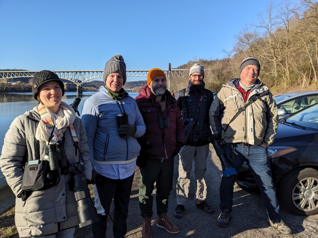
Duck Hollow outing, 24 March 2024 (photo by Kate St. John)
My next outing will be sooner than usual, just three weeks from now in Schenley Park on Sunday 14 April at 8:30am. Stay tuned.
Duck Hollow, Allegheny, Pennsylvania, US Mar 24, 2024 8:30 AM – 10:00 AM
Canada Goose (Branta canadensis) 11 Wood Duck (Aix sponsa) 1 bird. Only one person saw it. Mallard (Anas platyrhynchos) 4 Hooded Merganser (Lophodytes cucullatus) 2 A very distant pair. The male’s crest was raised and he was flinging back his head in courtship display Common Merganser (Mergus merganser) 1 Pied-billed Grebe (Podilymbus podiceps) 1 Mourning Dove (Zenaida macroura) 4 Killdeer (Charadrius vociferus) 1 Herring Gull (Larus argentatus) 2 Great Blue Heron (Ardea herodias) 1 Turkey Vulture (Cathartes aura) 8 Cooper’s Hawk (Accipiter cooperii) 1 Belted Kingfisher (Megaceryle alcyon) 1 Downy Woodpecker (Dryobates pubescens) 2 Northern Flicker (Colaptes auratus) 2 Eastern Phoebe (Sayornis phoebe) 1 Blue Jay (Cyanocitta cristata) 2 Carolina Chickadee (Poecile carolinensis) 3 Tufted Titmouse (Baeolophus bicolor) 2 Golden-crowned Kinglet (Regulus satrapa) 2 Carolina Wren (Thryothorus ludovicianus) 5 Northern Mockingbird (Mimus polyglottos) 2 American Robin (Turdus migratorius) 7 House Finch (Haemorhous mexicanus) 4 American Goldfinch (Spinus tristis) 7 Dark-eyed Junco (Junco hyemalis) 1 White-throated Sparrow (Zonotrichia albicollis) 1 Song Sparrow (Melospiza melodia) 7 Red-winged Blackbird (Agelaius phoeniceus) 17 Brown-headed Cowbird (Molothrus ater) 3 Common Grackle (Quiscalus quiscula) 1 Northern Cardinal (Cardinalis cardinalis) 16


