
30 September 2022, 6am
UPDATE 30 SEPT, 6 PM. See UPDATED info at end
After wrecking a swath of Florida, Hurricane Ian popped out over the Atlantic Ocean, gained strength, and is bearing down on the Carolinas. Though Pittsburgh is quite far inland we will see the remnants of Hurricane Ian’s rain on Saturday.
These maps show total rainfall forecasts for the next three days as Hurricane Ian moves up the eastern U.S.
 Quantitative Precipitation Forecast, Fri 30 Sep - Sat 1 Oct 2022 (map from NOAA)


Quantitative Precipitation Forecasts, Continental US, 30 Sept to 3 Oct 2022 (maps from NOAA)
Pittsburgh will receive less than an inch of precipitation because Ian is tracking south and east of here. Fortunately this is far different from our experience of Hurricane Agnes 50 years ago.
UPDATE 30 SEPT, 6 PM. I have corrected the captions on the slideshow based on an email from Dick Rhoton. Note that the slideshow maps show total rainfall potential, no matter what cause.
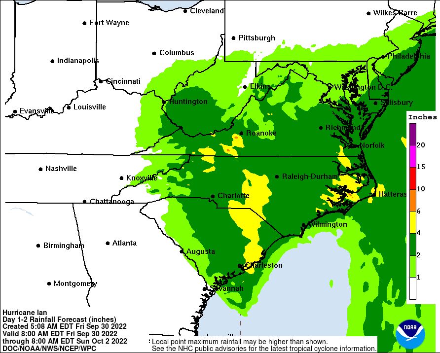
This map shows rainfall potential from Hurricane Ian alone — anything greater than an inch — as of 30 Sept 2022, 6am.
(maps and animation from NOAA; click on the captions to see the originals)